Mapping
Talk to any pilot whose job it was to fly over Aden
and its Protectorates and one of the major problems they encountered was a lack
of accurate maps by which to locate their destination, be it airfield or town
or, from a military perspective, an intended target. The task of improving this
situation began in 1964 as is conveyed in the article below, contributed by Richard Grevatte-Ball of 653 Squadron, AAC.
The 31st of July, 1967, marked the end of a major mapping
task undertaken by 42 Survey Engineer
Regiment; namely the first block of twenty-two sheets of a new 1:100,000
scale series of South Arabia (K669). In 1964
there was a 1:100,000 scale series (K667) in existence but it was mainly
without contours and it was neither very
accurate nor complete because of lack of survey ground control and
topographic information at that time. It was clear that high quality up-to-date
maps were required and that to produce them would be a major task to which a
large slice of the Survey Service potential would have to be allocated.
The available ground control was sparse, consisting, in one area, of a number of
old triangulation stations surveyed by Capt R.A. Wahab, RE, in 1891-92 and by
Capt M.O’C. Tandy, RE, in 1901-04 and also a coastal traverse along the Southern
edge of part of the area. This control had to be intensified and 13 Field Survey
Squadron RE, already stationed in ADEN at the time, were given this difficult
task. The work involved establishing new plan and height control points all over
the area while at the same time collecting names and annotating all the air
photographs with information not obtainable from them in the office such as the
position of wells, track classification and vegetation details. Progress was
slow due to the difficult country, dissident tribesmen and other demands on 13
Squadron. Reinforcements at troop strength from 19 Topographic Squadron of the
Regiment were therefore sent out to help with the work. The presence of
dissident tribesmen is no new experience to RE field surveyors in many parts of
the world as is evidenced by the following three passages from Capt Tandy’s
report on the Aden Boundary Survey Detachment (1901-04).
“On 18 February, a party started with the intention of visiting Huria, an
intersected point of the old survey on the Radfan range; three marches to the
south-east of Dthala and previously unvisited; after slight difficulty with the
local Arabs, a village within two miles of the top of the hill was reached, but
from here owing to the open hostility of the natives who fired on the party, it
had to beat a hasty retreat without doing any work.
During our visit to Rube’aten the camp at Awabil was attacked from 07:00 to
midday on the 13th by some 2,000 Arabs, who were however driven off with small
loss on our side. The following day the surveyor continued the work in which he
had been interrupted, but accompanied by an escort of fifty men with a maxim
gun, work progressed peacefully till on nearing the village of Hada’ra, about
forty Arabs appeared in front of the party on whom they fired, firing was brisk
on both sides for some moments until the Arabs retired, but not before they had
shot Sub-surveyor Mohamed Latif in the head and wounded one of his escort.”
The Regiment was to be responsible for all stages of producing the maps
subsequent to the field surveys. Basically this involved intensifying the ground
control still further by air survey methods, plotting the detail and contours
from air photos on air survey plotting machines, compiling the map, fair drawing
(scribing) and printing. Work started in earnest in January 1965 and the first
main task was to produce a pilot sheet to see whether the specification met the
requirements of the many potential users. This was particularly important for
this series because it was to be the first military medium scale series to have
fully modelled hill shading, an addition which it was hoped would help all users
and in particular the pilots of light and strike aircraft.
This pilot sheet was finished in October 1965, printed in various styles and
copies were sent out to Aden
 for short trials. The local reaction to the sheet
was very encouraging and with the specification finally decided work on the
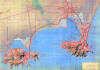
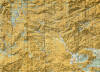
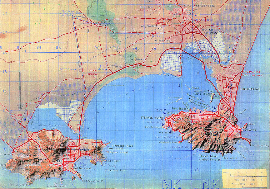
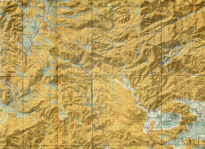
other sheets continued fast. An extract from one of the sheets covering an area
which will be well known to many Sappers and pilots who have served in South
Arabia can be displayed by clicking this thumbnail.
for short trials. The local reaction to the sheet
was very encouraging and with the specification finally decided work on the
other sheets continued fast. An extract from one of the sheets covering an area
which will be well known to many Sappers and pilots who have served in South
Arabia can be displayed by clicking this thumbnail.
At this stage the deadline for the completion of the twenty-two sheets was
brought forward to 31 July, 1967, a decision which resulted in continuous shift
work in the Regiment mainly in 47 Cartographic Squadron. From August 1966 sheets
were completed at the rate of approximately one each month. For various reasons
it was decided that actual bulk printing of each sheet would be carried out by
13 Squadron in Aden after each final proof had been produced by the Regiment.
This arrangement continued until June 1967 when due to the return of 13 Squadron
to UK, 22 Lithographic Squadron of the Regiment were tasked with the printing of
the last ten sheets. On 28 July, 1967, three days before the deadline, the last
sheet was cleared.

 for short trials. The local reaction to the sheet
was very encouraging and with the specification finally decided work on the
other sheets continued fast. An extract from one of the sheets covering an area
which will be well known to many Sappers and pilots who have served in South
Arabia can be displayed by clicking this thumbnail.
for short trials. The local reaction to the sheet
was very encouraging and with the specification finally decided work on the
other sheets continued fast. An extract from one of the sheets covering an area
which will be well known to many Sappers and pilots who have served in South
Arabia can be displayed by clicking this thumbnail.